Here we are half way through our trip and starting to head back up towards the Netherlands.
Our last stop in Italy is Cinque Terre. Our whole trip sort of started when I was reading out my 101 Things to do in My Life list that I wrote in 2006 to Nigel. One of them was to hike the 5 medieval villages in northern Italy. I had missed out on this when I lived in Italy.
We camp at a coastal town slightly further up the coast called
Deiva Marina. From here a coastal train runs right through all the villages including these five. You can extend your walk to include a
number of other towns on either end, but these are the main five. To
hike these 5 you need to purchase the Cinque Terre Card for 5
Euros at the start of your journey (or actually at any number of booths
along the way that check for your card). We take the train to our first town called Riomaggiore (pictured above) very early in the morning to use as much of the cool of the day as possible.
Above is the town map of Riomaggiore. It is always handy to find this as soon as you enter a town to have some notion of whether or not you are in the main bit.
The first thing I notice in the town are the murals. Mostly done by Mario Andreoli (pictured above).
Apparentley this first town is the easiest to get to by road making it the most crowded. But at this early hour it certainly isn't busy at all. Although before long a few tour buses start to arrive.
The harbour is really nice and we wander around since the office to buy our passes has not yet opened.
This town was settled in the 8th century by Greek settlers fleeing persecution in Byzantium.
The view with the harbour.
The first walk between the villages is the shortest and easiest. Named Via dell'Amore (Lover's Path), it is a gentle and paved 20 minute walk. Somehow we delude ourselves into thinking that the rest of our journey will be relatively the same. In fact, before I came I always thought the towns were so far apart that you had to spend a day hiking between each with your tent and sleeping bag on your back, finding a campsite each night to bed down. Very Canadian thoughts, I now realise. Nigel on the other hand thought it was a nice easy stroll on paved ground between each and even said he expected to be back at our campsite just after noon. Well, the reality was somewhere in between those. Or another option that a lot of tourists choose is to get a day train pass between all the towns and just train it to each. As we arrive after hiking between each town we repeatedly note the same young American couple sitting at a new restuarant in each town. Clearly someone is not walking those trails!

Manarola is the second town and squeezed up into a ravine up the hill while also teetering over the rock face cliff above.
The town map shows the one main street
winding up a steep slope and little passages and stairs surrounding it.
Hey, let's do the tourist thing and pose with the town behind me.
Nigel too.
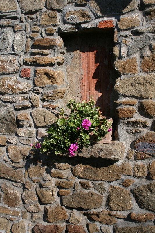
Just on the outskirts altars are randomly placed in rock cliffs.
Manarola has a lovely main square with an amazing stone mosaic.
A detail.
The next stretch between Manrola and Corniglia is closed. Thankfully (I think) there are alternative foot paths. Each of the Cinque Terre villages is associated with a sanctuary perched high on the cliff-sides above the Mediterranian. According to the Lonely Planet, reaching these religious retreats used to be part of a hefty Catholic penance, but these days the walks through terraced vineyards and across view-splayed hills are a lot less onerous. Hmmm. Really?
My main aim when I read up on the area is to hike between each town and up to each sanctuary. But the first alternative route up to Volastra (associated with Manarola) was tough as we scale 340 metres in the growing heat.
First we climb and climb through row upon row of olive trees.
There is a stern warning to bring both a hat and a lot of water.
The olive trees often have netting tied up under them for harvest time.
We finally reach the tiny village of Volastra high up on the mountain, the only mountain sanctuary we plan to go to.
It is indeed a sanctuary. You can tell not as many tourists make it up this far as it is quite quiet and peaceful. Neither are there trains running this high. Santuario della Madonna delle Salute is pictured above, a beautiful and simple church inside.
Perhaps we delude ourselves again at this point in thinking we are heading down hill to the next coastal town. But no, we are climbing for a while from peak to peak.
We walk through endless vineyards. What I like about Italy is it hasn't yet been caught up with the Health and Safety regulations that the rest of the West has. It is hard to photograph the tiny eroding paths that we cross with cliffs on one side. It is frightening to pass someone going the other way. Often one person has to cling to the cliff while the other holds on to them and places one foot at a time on the other side.
It is an amazing view and astonishing to see people working the vineyards at such a great height.
Every so often we pass a tiny town no bigger than a few houses in the tops of the mountains.
Thankfully we have shade some of the time.
We can't figure out why the majority of the people on the trails and in the towns are Americans when we haven't run into many Americans in the rest of our Italian journey.
In fact, we start chatting to one couple as I notice her shirt is from the Vancouver store, Lulu Lemon. I ask her if she is from Vancouver. No, she says. Lulu Lemon has now reached the States. I ask her why there are so many Americans on the trail. They have no idea but like me also thought it was going to be a vigorous hike taking a day between each village. Some sort of North American myth perhaps?
Finally we reach Corniglia, the smallest and most remote of the 5 villages. It clings to a high cliff 90m above sea level. Above is the oddest statue in the main square. Sort of Vampire meets Zombie.
The little Gothic church of San Pietro there is beautiful in the interior.
And features a marble rose window. We sit down and pull out our lunch to eat.
Here we can finally see a view of the village as we leave it.
A further view that shows how high it actually is. In fact the train station is way down below at sea level and the only access to the village from there is a mighty long flight of stairs. I suppose whichever way you enter this town you look pretty winded.
A view from the top showing not only Corniglia, but the last village of Manarola behind it. The walk between those two villages turns out to be the hardest of all of them. The rest are by no means easy but are less than the last 2 hours.
More olive groves as we descend and make our way towards the 4th village of Vernazza. On our way we notice a bundle of black plastic pipes (no bigger than 2 inches) tied together heading down a ravine. Nigel jokes that it is the towns water supply coming from a spring uphill. We realise as we enter town he is probably right.
We descend from above it.
In honour of our plumber, Les Ward, we take a picture of what looks like a medieval town who at some point decided to put in a water system but didn't want to disturb anything to do it.
Here we have the town's water supply heading to various locations.
And, oh, that house wants water...just stretch a pipe directly to the house through the air. Job done.
The guide books tout Vernazza as the prettiest of the 5 villages and as soon as I enter I agree. The main drag, Via Roma, leads down through the town, is large and feels like one long piazza. There are cafes and restaurants lining it the whole of the way and the town is bustling with activity and tourists even in the end season of September.
We wander around and spot the same young American couple at a table. We left them last as we headed off to this village and presume that like most of the people roaming around they caught the train here.
The harbour is amazing. It is large and all sorts of activity is going on. There is a wall and walkway that runs out in a protective arm (photo from that spot) including a small beach that people are swimming at. We sit in the harbour for a rest and snack and watch all the activity going on.
Okay, I am going to be honest with you. I sort of like the idea of the older man with the skimpy speedo and tanned body/pot belly that you get so much of in Europe. I really do. This man above was the busiest water taxi in the harbour as we sat there. You couldn't help but notice him driving to and fro in his neon yellow skimps. We saw a sign at some pool in Italy along the way that said "No Shorts Allowed. Proper Swimming Briefs Only." There you go, men!
Each town has a main water fountain and many people, including us, fill our bottles at each stop.
Another altar randomly built into the underside of some stairs.
I didn't find this town map right away, but here it is.
We wander a bit back up the hill through the narrow streets to find the trail again.
We decided not to swim this time but to carry on as it has been burning hot for some time and the sooner we get to the last town, the better. We are counting on a beach there.
Vernazza has recently had some terrible flooding and landslides in the town and as we exit the town a nearby house in the hills seems to have recently dropped away into the river bed. You can still see things in the cupboards.
We begin another ascent again. In the burning sun. Centuries old stairs. One step at a time. The blue route which doesn't include all the sanctuaries is 12 km long. We can add to that since one of the stretches was closed and the alternate route (the red route) is at least double that section.

You can just see Vernazza from the height we climb in a short space of time. During this stretch a couple walk by Nigel, read his shirt, and say "Whistler! Hey, I am from Whiterock". Nigel calls out, "my wife is from Canada." A bit later we are hiking right behind them and start up a conversation about Vancouver where I tell them I am from. Somewhere into talking they stop and ask me, "so, how long did you say you visited Vancouver?". I understood them to believe I was British. This stunned me. "I grew up there!" I said. "I have only been in Britain for 7 years! Do I sound British?" "Yes." What?! Nigel said that my accent changes quite a bit when I go back home and he phones me from Britain. He thinks I then sound totally Canadian again. I am stunned. I just can't believe I sound that British. Although when I hear their accents I know I don't sound like them either. But my family has a much milder accent.

We round the corner and catch site of the last of the villages, Monterosso. We are almost at the end, although Nigel has mentioned hiking a further hour up to the mountain beyond for the perfect view of all 5 villages looking down the coast.
After 8 hours of hard climbing in the hot sun we head for the beach, change right there (it is Europe, after all), and head into the water as fast as our tender feet can carry us over the rocks. Ouch! Ouch! Ouch! Ouch! Ahhhhhhhhhhh!
Monterosso is the oldest of the villages and was founded in AD 643 when the beleaguered hill dwellers moved down to the coast to escape from invading barbarians. The trail we hiked (blue trail) dates back to the early days of Republic of Genoa in the 12th and 13th centuries and, until the opening of the railway line in 1874, was the only practical means of getting from village to village. The Azzuro (blue trail) is a "narrow, precipitous hike, though people of all shapes and sizes complete it every day" (Lonely Planet). And sure enough there are all shapes, ages and sizes on the trail at even the hardest points. It is quite unbelievable really, but it is a walk that, like me, is on people's list to do in their lifetime.

Monteresso is the chief village of the Cinque Terre and it is not hard to see why. It is the largest with a population of 1800 and the most developed. It has the feel of a seaside resort with the charm of the old. Note the painted stripes on the building above. There is a great amount of trompe l'oeil painting on the buildings that give the illusion of grand arches and sculpted fascades.
The busy town centre.
From Monterosso we catch the train just two stops further up to our campground which we can see the moment we step off the train. Hidden behind the pink house in the olive orchard.
It is one of the best campsites so far and not part of our ACSI camping membership. It is a bit pricier at 25 Euros a night, but well worth it given its location (50 metres from the beach, from the town, and right next to the train station). Beware if you come to Deiva Marina that there are other campsites that are terrible. You will see a sign for 3 campsites across a small bridge in the town along the waterfront that crosses a dry river bed (with an ostrich wandering randomly in it). AVOID the other two campsites unless you want the Shanty Town feel or the Blinding HOT Unshaded Gravel Plot feel. Instead turn left and go to the smallest little campsite nestled into an olive grove called Camping degli Ulivi.

The site seems designed by an architect with its round toilet block hidden in the hill and the sites spiraling out from it. Each site, which is quite large and spacious and on a different level tier, has a sink and draining board. How can you go wrong? There is also free wifi, clean bathrooms, and bidets.


1 comment:
Hello
I have got a chance to book a room at that camping. Maybe you could help me? There are bungalows and houses but for two people I was offered a room. Did you see any of those? Can you recommend the rooms?
I'll be grateful
Kamila Wojcik (Poland)
Post a Comment